
 Photo by Google Maps, Screen Shot of Aragon, Spain on August 16, 2012 by William Ulmer.
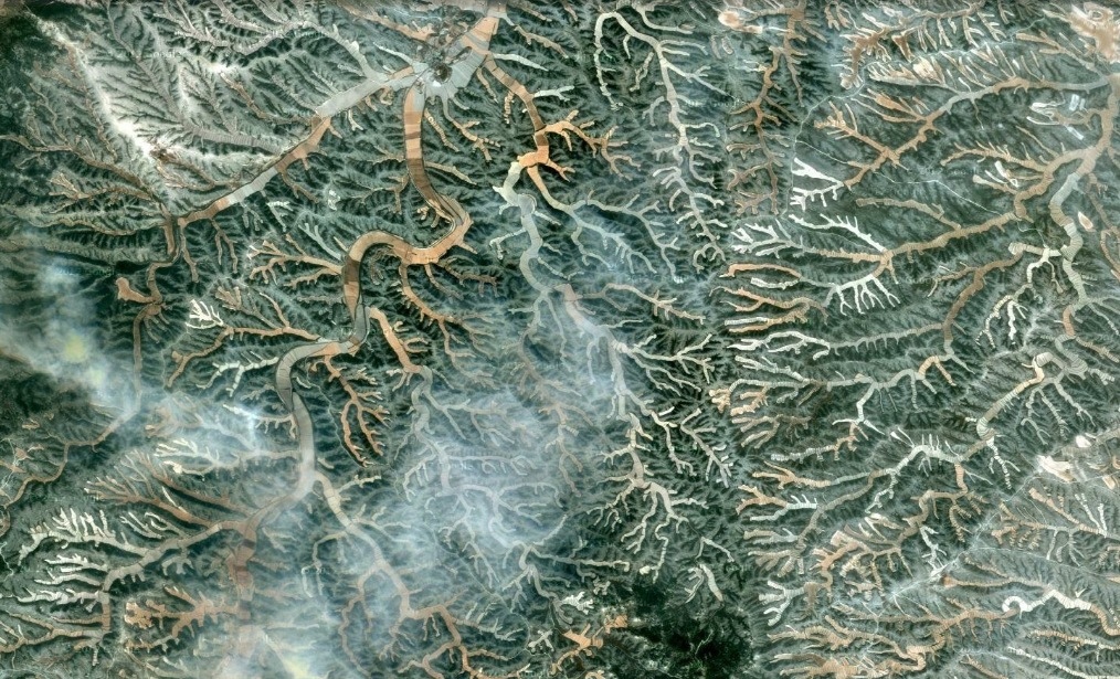
As a follow up to my recent blog on Spain I thought I would post my first reblog of sorts. Last year the NY Times magazine section featured some amazing arial photography by Edward Burtynsky, which I have also found highlighted here in Time Magazine. The professional photos were all taken from 2,000 feet while flying in a helicopter, so I wondered if I could create a few new compositions using the satellite images of Google maps. The image above is from one such Google Map screen screen over Aragon, Spain.
I am quite impressed by Burtynsky and would love to see his work highlighted at my local Peabody Essex Museum in Salem, MA… Time to get on that Mr. Prodger!
